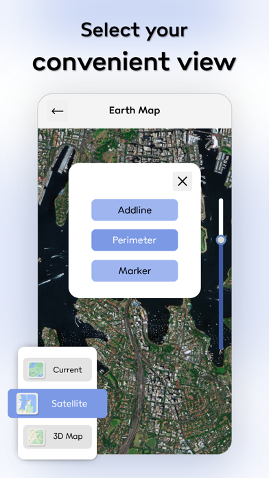
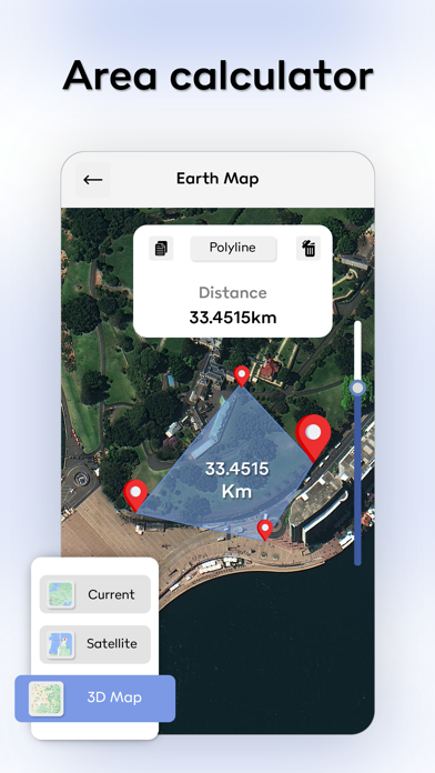
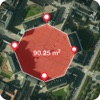
Distance Tool allows for quick and easy calculations to find distances between points on a map, including area calculations for non-overlapping polygons drawn. Includes metric (meters, kilometers) and imperial units (yards, miles, feet for altitude) for distances. Co-ordinates can either be displayed in decimal or degrees, meters and seconds. Useful for mapping fields in agriculture, plots of land/home boundaries, or for general interest in distances and areas! Allows the standard map views of standard, satellite and hybrid. Supports quick altitude calculation without data connectivity. Find out how high up you are! Or see the altitude of ANY point (requires data). For more information : Privacy Policy : http://gayatrisonaniapps.website2.me/ Terms of Use : http://gayatrisonaniapps.website2.me/terms-of-use