You Need A Map

You Need A Map

By GrangerFX

  • Category: Navigation
  • Release Date: 2011-01-31
  • Current Version: 1.9.2
  • Adult Rating: 4+
  • File Size: 66.01 MB
  • Developer: GrangerFX
  • Compatibility: Requires iOS 16.1 or later.
Score: 4.26087
4.26087
From 46 Ratings

Description

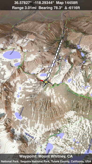
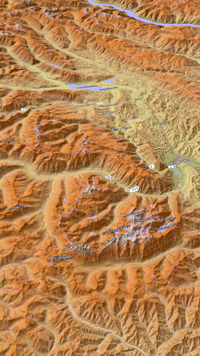
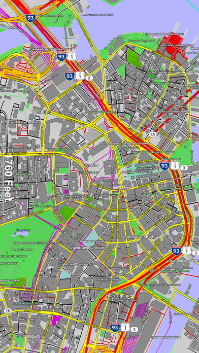
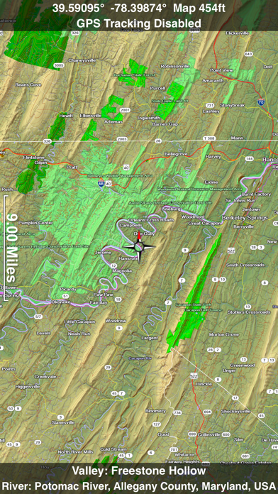
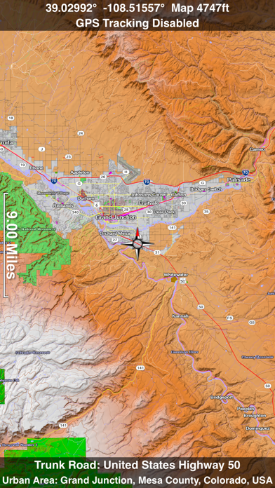
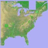
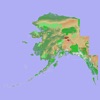
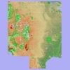
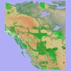
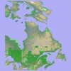
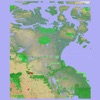
If you get lost or in an emergency, YOU NEED A MAP! A map that covers the entire USA, all 50 states. A map that works everywhere even without a cell phone signal. A map that shows not just roads but also terrain, streams, lakes and other landmarks. Note: If you would prefer a small app that caches online maps covering the entire world, please see the More by GrangerFX section below and try the free Scenic Map app. Get You Need A Map if you want an offline map the entire USA as a single large download. The paid apps have built in maps with full resolution terrain. Your iPhone has a great online map but all it takes is one wrong turn and you could find yourself lost with no cell phone signal. What is the fastest way back to the highway? Should you go forwards or back? Is there a better road just a short distance away? Is there a raging stream or an steep cliff between you and the road? YOU NEED A MAP! You Need A Map is a huge application. It has to be. It contains every mountain, hill, stream, lake, pond, freeway, highway, local road and track. In addition it contains many buildings, trails, railways, points of interest and polygon features. It has everything you need to find out where you are and what is around you anywhere in the USA. Most navigation apps on the iPhone and iPad must transfer all their maps from servers on the internet. This can be slow in areas with only 2G coverage or completely unavailable in wilderness areas where a map would be most useful. You Need A Map solves this problem by storing maps directly on your iPhone or iPad. This extremely fast high quality software renderer is the first of its kind for mobile devices. If you do have a cellular or WiFi internet connect, Satellite image overlays add breathtaking detail and realism to the maps (tap preset 2 or 4 when Online Map is enabled). You can use them as you travel to see what is hidden from view at ground level. This takes moving maps to a whole new level. Tap the arrow in the toolbar to enable GPS tracking. As you move, you will generate a track file which you can replay. You can also import GPX tracks generated in other programs and play them. While recording or playing a track, the map will be centered on the current location and rotated towards the direction of travel and rendered in 2D or 3D with silky smooth animation. When playing a track, you can speed up, slow down, pause, restart or skip to the end. Send your GPX tracks to other apps or email them. Want to learn more about a map feature? Click the target icon and center it under the compass rose to display its name, feature type, urban area, state, elevation and coordinates. You will also see a bearing line back to your current GPS location or from your location to a selected waypoint. The status will display the direction and distance along with the map and GPS elevation, the track length, and your current speed and direction of travel You Need A Map uses the same code as Scenic Map and has most of the same features. These include many map customization options, customizable waypoints, direction and bearing information, a smooth scrolling moving map display while driving or flying, city search and much more. You can also get the full feature set of Scenic Map with an in-app purchase including the new online maps of the entire world. Documentation, detailed coverage maps, installation guide and blog are available on ScenicMap.com You Need A Map covers the entire USA including all 50 states Map data © OpenStreetMap and contributors under the Open Database License You Need A Map supports GPS tracking while the app is in the background. Caution: Continued use of GPS running in the background can dramatically decrease battery life.

Screenshots

Reviews

  • Excellent

    4
    By Gundog55
    I’ve used this flying across the country as a pilot and in the mountains hiking. No cell signal needed and the ability to leave a track so you can follow it back out.
  • Dark Mode glitch

    5
    By Deadhorsenomad
    Hey developers, When using dark mode, all alphanumeric values in ‘tracks’ will not display. The portion of tracks that I can edit will only display emojis and nothing that I have written or what is programmed to be there prior to edit. The bottom segment of tracks that I can’t edit remains visible in either mode. Just thought I’d let ya know😎
  • Excellent update for an excellent app.

    5
    By Mjf101471
    The latest update is great! You can add GPX files directly from safari downloads via the share sheet. I couldn’t be more impressed with the app. I really appreciate the customer service. Prompt responses to emails and delivering the goods World class work. Thank you
  • Isle Royale, MI

    5
    By Spin737
    Great app. But where is Isle Royale, Michigan? The roads are there but the island is missing.
  • Name says it all

    5
    By Gordincolorado
    I know if I have this app on my phone and my phone in my pocket I can just start driving down a new trail some where in the bush and use this to get back later.
  • Powerful tool for Helicopter Search & Rescue

    5
    By jpavionics
    UPDATED 10-AUG-2018: I LOVE THIS APP- I’ve been utilizing this app as a back up (honestly, primary) to the onboard navigation equipment on a Navy MH-60S specifically for SAR Ops and identifying names and locations of local landmarks, roads, and popular trails such as the Pacific Crest Trail which is well marked within the app. UPDATE: I've also used all over the Pacific, midway, Japan, Indo, Vietnam, Singapore, Sri Lanka, PI, Indo-Asia area with zero issues. I've found that if I know where I'm going ahead of time, I'll get on Wi-Fi or data and conduct a map study, zoom in, and then cache the maps with the necessary zoom in detail as required for my flight missions. The only downside to this app is that it requires around 2GB of memory on your device to store the 3D maps (UPDATE: I got a new phone so memory is no longer an issue). But for what I do, even if I was limited on memory, I’m more than willing to give up that space on my phone/ipad for this app and the cached map data. Although I give it 5 stars, there is always room for improvement. For instance, I've got a lot of stored waypoints. I'd like to be able to prioritize my favorite waypoints towards the top of my list instead of having to scroll all the way to the bottom just to access my most frequently used ones. (If there is a way to already do that, I haven't figured it out). Also, I'd like to see the satellite imagery updated. For the price of the app and In-app Purchase, this is the best tool for the SAR community that I’ve used so far. I’ve paired my phone with a Bad Elph GPS Rx’r for better SAT reception when the phones onboard Rx’r just won’t cut it. The app eats up battery quick so when using it for extended searches/Nav, make sure you’ve got an external battery.
  • Looks good and I would love to try it

    1
    By Just me thank you
    But it won't download.i tried hundreds of times to get it to download.its not my iPad because I checked so it has to be the app.please fix so I can try this app.thank you.
  • Updates TOO BIG!!!

    1
    By FN1234###
    You download this app when you purchase, and it’s huge. That’s understandably because it’s a bunch of maps. Then GrangerFX discovers “minor bugs” and their solution is to have everyone download the ENTIRE THING again. We’re talking IN EXCESS OF 2GB for EVERY update. Monumental waste of bandwidth! These guys need to go back to school and redesign this entire thing, so it doesn’t need to be such a pain. Until that happens IT IS NOT WORTH IT!!! Update: here's the response I got from GrangerFX, MONTHS LATER: "Please consider using the free stand alone Scenic Map app. It has a very small download and gets map data from the cloud". So their answer (to the challenge put forth to reduce their bandwidth footprint by fixing how they update their app) is "Thanks for giving us your money, now go back and use the free version". There is a trend with developers to abandon the traditional elegance of coding using minimal code. With this app it goes to the extreme. Updates that consume gigabytes of bandwidth is lunacy. I still say AVOID THIS APP and I'll now go further: I'd recommend avoiding ANYTHING from this developer. Not only do they lack skill -- they have no respect for their customers, no understanding of the iOS environment, and no grasp of their profession. Hey GrangerFX: "Please consider another business model away from mobile devices - something where bandwidth doesn't matter. As for your treatment of customers, you are right up there with United Airlines. CONGRATULATIONS!"
  • Great for back road travel

    5
    By kapenske
    If you just need city and big highway maps then download anything. They're all the same. BUT if you get off-road or deep into the back country GET THIS APP. I've tried many. This beats them all.
  • Thanks

    4
    By Juniorwanderer
    I like the user interface, very easy and intuitive! Thank you for the app!

keyboard_arrow_up